JOURNAL PUBLICATIONS
A critical review of flood risk assessment in Kerala Post-2018: Methodological approaches, gaps, and future directions
Amrie Singh | Sreeparvathy Vijay | Sengupta Debdut | Maria Pregnolato | Nigel Wright
Journal of Hydrology: Regional Studies (2025)
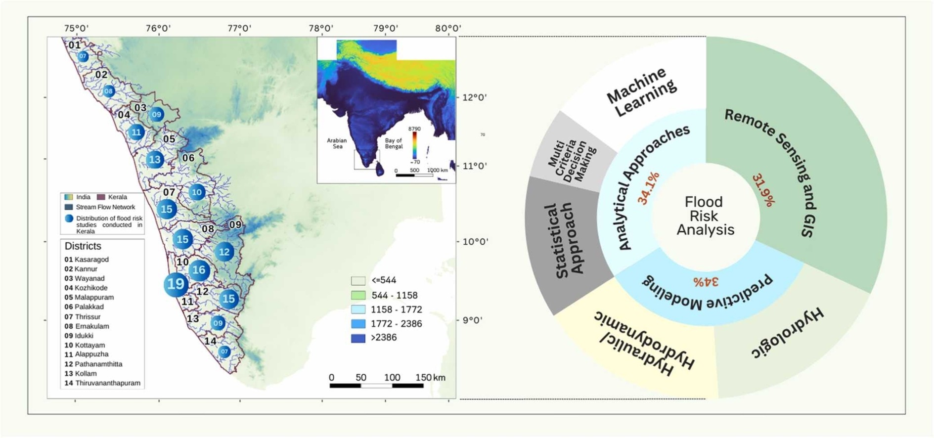
This review critically analyses the literature on flood risk assessment (FRA) in Kerala, particularly after the devastating 2018 floods. Kerala has experienced sporadic floods in the 21st century, caused by localized heavy rainfall, rapid urbanization and improper management of water resources. The 2018 Kerala Floods was one of the most catastrophic recent floods. Nearly all 14 districts were affected, over 480 people lost their lives, and more than a million were displaced. Anthropogenic factors, such as encroachment on wetlands, sand mining in riverbeds, and inadequate drainage systems in urban areas, have worsened the impact of floods. Despite the long history of flooding, flood management in Kerala has struggled to keep pace with the increasing magnitude and frequency of these events. Factors such as outdated infrastructure, uncoordinated dam management, and poor urban planning have exacerbated the impacts of floods. Against this backdrop, this review on flood risk assessment (FRA) in Kerala evaluates and synthesises existing methodologies to improve understanding of current state-of-the-art FRA in Kerala and provide a foundation for more effective flood management strategies.
Meteorological flash droughts risk projections based on CMIP6 climate change scenarios
Sreeparvathy Vijay | V. V. Srinivas,
npj Climate and Atmospheric Science, Nature Publications (2022)
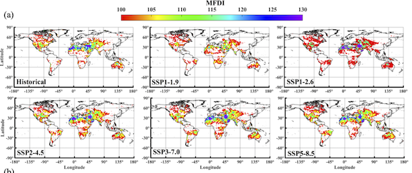
Meteorological flash droughts (MFDs) are sub-seasonal-to-seasonal drought phenomena characterized by rapid onset/intensification. This study assesses the changes in trends and hotspot regions of MFDs for the present and five future CMIP6 SSP forcing scenarios (SSP-FS) at global-, continental- and regional-scales. Analysis with 12 GCMs indicates that globally, frequency, duration and severity of MFDs are projected to increase ~20–50%, 20–58%, and 26–62%, respectively, with the highest occurrence probability during the summer season. The MFD hotspot regions appeared prominent in arid and semi-arid zones. MFD exposure risk is projected to exceed ~1.5 folds in most continents, with the highest risk in the Indian sub-continent. Furthermore, in Europe and South America, which are currently less impacted by MFDs, a considerable increase in hotspot regions (~122–127%) is projected under the warmest SSP-FS. The LULC-classes and elevation range most vulnerable to MFDs, and regional potential hydrometeorological drivers that trigger the development of MFDs are identified.
A Bayesian Fuzzy Clustering Approach for Design of Precipitation Gauge Network Using Merged Remote Sensing and Ground‐Based Precipitation Products
Sreeparvathy Vijay | V. V. Srinivas,
Water Resources Research (2022)
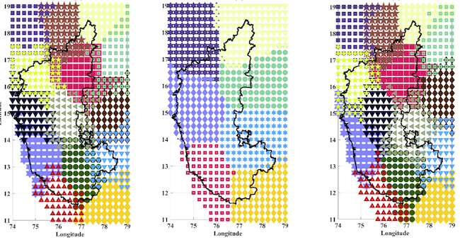
A two-level clustering approach is proposed for optimal design/expansion of a ground-based precipitation monitoring network (GPN). It harnesses the advantages of Infinite Bayesian fuzzy clustering in the first level to partition the study area into homogeneous precipitation zones by considering structural/statistical characteristics and temporal variability of the observed precipitation. In the second level, an ensemble of hierarchical and partitional clustering techniques is considered in the time domain to effectively partition each zone into groups by considering weighted inter-site dissimilarities of precipitation. The dissimilarities account for correlation, temporal dynamics, and fuzzy mutual information of precipitation at existing stations and possible new gauge locations. Key station’s location in each group is identified by a proposed ranking procedure that accounts for population density, land-use/landcover, and fuzzy marginal entropy of precipitation. For use with the approach, information on precipitation was derived for fine resolution ungauged grids covering the study area using random forest-based regression relationships developed for gauged grids between merged multiple satellite-based precipitation products (CHIRPS, IMERG) and ground-based precipitation measurements. The potential of the proposed approach over other clustering-based procedures is illustrated through a case study on a GPN comprising 1,128 gauges in Karnataka state (191,791 km2) of India. Potential locations for installing new gauges and areas where there is scope for relocating existing stations are identified. The proposed methodology appears promising and could be extended to design networks monitoring various other hydrometeorological variables.
Global assessment of spatiotemporal variability of wet, normal and dry conditions using multiscale entropy-based approach
Sreeparvathy Vijay | V. V. Srinivas,
Scientific Reports, Nature Publications (2022)
In recent decades, human-induced climate change has caused a worldwide increase in the frequency/intensity/duration of extreme events, resulting in enormous disruptions to life and property. Hence, a comprehensive understanding of global-scale spatiotemporal trends and variability of extreme events at different intensity levels (e.g., moderate/severe/extreme) and durations (e.g., short-term/long-term) of normal, dry and wet conditions is essential in predicting/forecasting/mitigating future extreme events. This article analyses these aspects using estimates of a non-stationary standardized precipitation evapotranspiration index corresponding to different accumulation periods for 0.5° resolution CRU grids at globe-scale. Results are analyzed with respect to changes in land-use/landcover and geographic/location indicators (latitude, longitude, elevation) at different time scales (decadal/annual/seasonal/monthly) for each continent. The analysis showed an (i) increasing trend in the frequency/count of both dry and wet conditions and variability of dry conditions, and (ii) contrasting (decreasing) trend in the variability of wet conditions, possibly due to climate change-induced variations in atmospheric circulations. Globally, the highest variability in the wet and dry conditions is found during the Northern hemisphere's winter season. The decadal-scale analysis showed that change in variability in dry and wet conditions has been predominant since the 1930s and 1950s, respectively and is found to be increasing in recent decades.

A fuzzy entropy approach for design of hydrometric monitoring networks
Sreeparvathy Vijay | V. V. Srinivas,
Journal of Hydrology (2020)
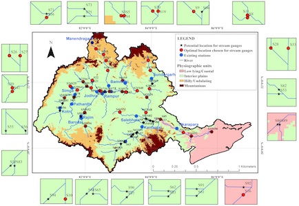
This paper proposes a fuzzy entropy-based methodology for optimal design and performance assessment of a hydrometric monitoring network that provides information essential for hydrological studies. The methodology does not require choice of bin size for discretization of data to estimate entropy measures/indices. Therefore, it alleviates the uncertainty associated with bin size estimation which is a concern in analysis with conventional Shannon entropy-based methodology (SEBM). Advantage of the proposed methodology over SEBM and its related theoretical improvement EEBM (exponential entropy-based methodology) in arriving at optimal design of streamflow monitoring network is demonstrated through performance investigation on Mahanadi basin of India, which is frequently prone to floods. Following this, the methodology is used to assess the performance of streamflow monitoring networks in 16 river basins of Peninsular India and identify stream gauge deficit zones. This study is first of its kind which evaluates the effect of different entropy estimation methods and bin size estimation rules on: (i) prioritization of stream gauge stations for their importance in data collection, (ii) identification of stream gauge deficit zones, and (iii) design of optimal hydrometric network in a river basin. Proposed methodology appears promising and offers scope for application to networks monitoring various other hydrometeorological variables.
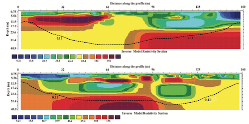
Application of ERT, saline tracer and numerical studies to delineate preferential paths in fractured granites
Sreeparvathy Vijay | BVNP Kambhammettu | Srinivasa Rao Peddinti | PSL Sarada,
Groundwater (2019)
This paper proposes a fuzzy entropy-based methodology for optimal design and performance assessment of a hydrometric monitoring network that provides information essential for hydrological studies. The methodology does not require choice of bin size for discretization of data to estimate entropy measures/indices. Therefore, it alleviates the uncertainty associated with bin size estimation which is a concern in analysis with conventional Shannon entropy-based methodology (SEBM). Advantage of the proposed methodology over SEBM and its related theoretical improvement EEBM (exponential entropy-based methodology) in arriving at optimal design of streamflow monitoring network is demonstrated through performance investigation on Mahanadi basin of India, which is frequently prone to floods. Following this, the methodology is used to assess the performance of streamflow monitoring networks in 16 river basins of Peninsular India and identify stream gauge deficit zones. This study is first of its kind which evaluates the effect of different entropy estimation methods and bin size estimation rules on: (i) prioritization of stream gauge stations for their importance in data collection, (ii) identification of stream gauge deficit zones, and (iii) design of optimal hydrometric network in a river basin. Proposed methodology appears promising and offers scope for application to networks monitoring various other hydrometeorological variables.
