RESEARCH OVERVIEW
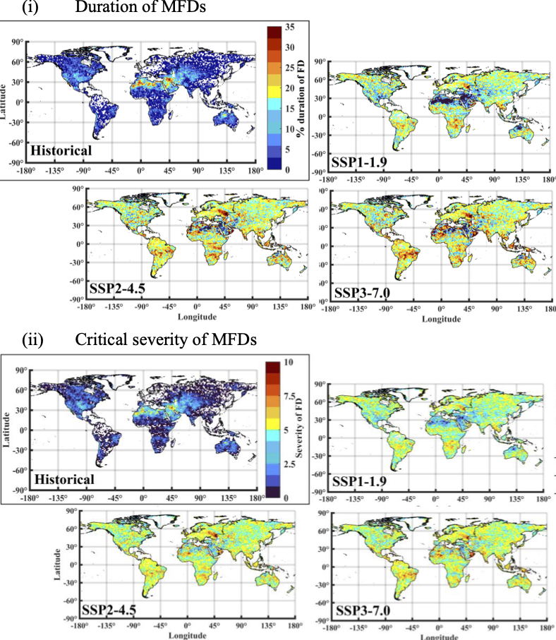
Hydrological Extremes and their Impacts in Changing Climate
The research aims to tackle the consequences of human-induced climate change, particularly the heightened hydrological cycle resulting in increased extreme hydrological events. These events can pose multifaceted impacts on the environment, society, and economy. Our focus is to provide a comprehensive understanding of the causes and drivers, characteristics, impacts, spatiotemporal distribution, and their correlation with climate change and human activities. Unravelling these aspects can help identify trends and vulnerable regions, providing valuable insights for developing accurate forecasting models and effective mitigation strategies to enhance resilience in the face of changing hydrological conditions.

Geospatial Data Science for Hydro-climatology
Our research in geospatial data science integrates deep learning (DL) and machine learning (ML) technique with Geodetic earth observations to advance hydro-climatic analysis. By harnessing satellite imagery, weather station data, and hydrological models, we acquire and integrate diverse spatial datasets to comprehend water resource dynamics, climate impacts, and water-related hazards. Our focus extends to monitoring surface and ground water dynamics, assessing vegetation health, and tracking land-use/land cover changes, prediction of changing hydroclimatic patterns and evaluate extreme event risks (flood, drought, heatwaves) across various spatiotemporal scales. The list keeps continuing with the advancement in the cutting-edge research carried out in geodesy, offering deeper insights into the interactions between climate, geography, and hydrology. Through our interdisciplinary approach, we develop robust decision support tools for water resource management such as flood risk mapping, drought early warning systems, and continuous monitoring of water quality. By integrating cutting-edge geospatial data science techniques with advanced ML/DL algorithms, we aim to tackle crucial challenges in sustainable water management and enhance resilience to climate variability. Our research not only contributes to scientific understanding but also strives to deliver practical solutions that empower informed decision-making and promote environmental sustainability in the face of changing climate conditions.

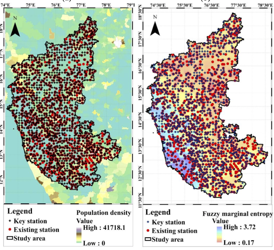
Design of Hydrometeorological Monitoring Networks
The spatiotemporal trends and variability of various hydrometeorological variables (e.g., precipitation, temperature) are increasing for the present and future climatic conditions, mainly due to increased anthropogenic activities and changing climate. Hence accurate and timely monitoring of these driver variables is essential in achieving various short-term and long-term goals. They include real-time preparation of weather analysis, predictions, and forecasting to provide early weather warnings, local weather-dependent operations (e.g., local aerodynamic flying operations, constructions), climate change analysis, agricultural operations, and water resources management. Therefore, this research primarily focuses on proposing novel methodologies for the optimal design of different hydrometeorological monitoring networks considering the present and future climatic conditions. The methodologies are proposed to collect real-time observations with minimal redundancy and maximum information gain for integrated water resource planning and management.
